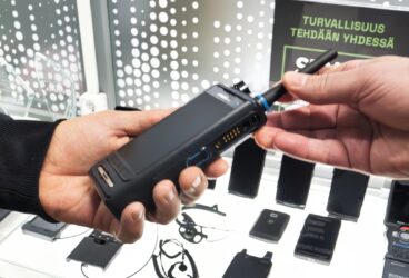
Mission Critical Top Tech Trends

This edition of Mission Critical Top Tech Trends 2022 focuses on the following topics:
- benefits and possibilities of drones for different security operator
- NTN (Non Terrestial Network), i.e., how to combine traditional technologies, such as satellite communications and mobile technology
Drones
Unmanned aerial vehicles (UAV) and drones in particular have been talked about a lot lately. Different kinds of unmanned aerial vehicles ranging from hot-air balloons to drones have been utilised to, for example, provide a mobile network in disaster areas where the communication infrastructure has been destroyed for some reason.
The first known air battle between drones was seen in Ukraine in October 2022 when a drone controlled by the Ukrainians brought down a Russian drone sending live feed from the combat zone. In Ukraine, we have also witnessed the efficiency of a remote controlled boat hit against the Russian navy and how surprising it was compared to traditional attacks by humans.
Unmanned vehicles have been utilised by the armed forces for a long time already. The technologies used in drones, their availability and the price level have developed so that the same technology is already used in much more ordinary duties by the authorities as well. The Police of Finland, for example, uses drones in different kinds of duties, and the rescue services prepared their own drone instructions years ago on how to obtain suitable live feed from the scene.
In the above-mentioned uses, air and waterborne vehicles completed their mission assisted by a person over a remote connection, mostly so that the person had a visual connection to the vehicle. In the near future, operations beyond visual line of sight (BVLOS) and autonomous operation will improve the possibilities and increase the possible uses.
Regulation is needed for evolving technologies
As technology offers new opportunities for use, a need for control and guidance arises so that drones, for example, can be operated safely in different environments and by different operators. Limits must also be set for the utilisation of information collected by means of technical assistance.
Finnish Transport and Communications Agency Traficom has given regulations about the use of drones, specified permanent and temporary prohibited and restricted areas, limits to vessel size as well as rules and limitations regarding the flying of drones. Autonomously operated drones have not been utilised fully in Finland so far, which is partly due to the degree of maturity of the technology, and partly caused by the agreed rules.
At the European level, U-Space regulation seeks to regulate and harmonise the use of drones. The goal is to ensure an airspace in which unmanned aerial vehicles can operate safely together with other air traffic. The Union seeks to further develop the regulation of the field as the use of drones becomes more common and the degree of autonomy increases. Safe autonomous operations can be used in a variety of different applications.
Drones of different sizes, quantities, ranges, degrees of autonomy and other properties can be used in different use cases. What is relevant are the objectives of the operations and the purpose for which the drones are used so that the actual payload required in addition to the basic operations can be determined.
Border control could be enhanced using flocks of drones fitted with suitable sensors, moving autonomously in the frontier zones, supplemented by data analytics used for, e.g., pattern recognition in the background. The operations of rescue departments could be enhanced by sending pre-analysed video feed enriched with additional information to the rescue units sent to a car crash site already before they arrive there. Emergency medical service operations could be supported by the use of drones to transport defibrillators and the necessary medical supplies to the site. The latter one of the possible uses mentioned is already in use in the Netherlands.
Miniature drones fitted with suitable sensors and cameras could improve railway safety by alerting either the train operator or the safety systems directly of any dangerous situations at a distance that still allows time to react but that is beyond the reach of the current observation methods.
In a sparsely populated country such as Finland, where the road network does not reach all the parts of the country or causes long detours, a drone is often the quickest way to bring help or an observation aid to the scene of an accident.
Finland has also been a pioneer studying the algorithms for utilising flocks of drones for searching.
The development of unmanned aerial vehicles and combining it with other technologies, e.g., sensor technology, artificial intelligence and machine learning or the development of, say, cloud technology and services gives security operators new possibilities to further improve their operations.
The 3GPP organisation focusing on the specifications for cellular telecommunication systems has specified unmanned aerial vehicles as an active development area. The organisation has paid special attention to the identification of drones and the administration of the resulting rights. Another focus area is the positioning of drones and the determination of the allowed area of operations, and the third one covers the remote control of drones.
Non-Terrestrial Networks (NTN)
In Finland, the maximum allowed flying altitude for drones is 120 m from the ground or water surface. Development is taking place even higher up above the surface, and more and more of technology interesting from the security operators’ perspective is starting to appear in the upper layers of the atmosphere.
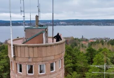
For decades, mobile phone networks have been operating over a terrestrial radio connection network consisting of base stations installed on the roofs of buildings or on masts, for example. Data communications of the end user have been transmitted from the base stations to the core mobile network using different technologies and then further on to the services.
For several years already, an operator-specific opportunity has been offered alongside the conventional base stations to utilise wireless networks, which were originally used as a part of fixed data communications. They are now offering the possibility to provide mobile network services through the shared core and safety framework. Satellite communications are another alternative data communications network that has been available for decades, operating at different preconditions than the terrestrial mobile phone networks.
Data communications satellites have traditionally circled the Earth in a geostationary orbit 35,785 km above the equator. The so-called GEO satellites keep their position with regard to the user of the terrestrial network user, but due to the long distance between the transmitter and the receiver, data communications are only possible using the terminal devices designed for this with a high transmitting power. This causes a delay in data communications, which is harmful to time-critical communications in particular.
In recent years, satellites circulating at a lower altitude (MEO, LEO) have been sent and taken into use faster and faster by different operators. Their operation is based on the changing position with regard to the terrestrial end user and the constellations formed by several satellites. Operating at the lower orbits has allowed the satellite technology to develop further and made it possible to launch smaller satellites to the orbit as a result of the decreased cost. Furthermore, the development of antenna technology has allowed the cost-efficient production of more sensitive receivers and more efficient transmitters.
The delay in communications transmitted through the lower orbit satellites circulating closer to Earth is smaller than that of those circulating in the geostationary orbit, and similarly, the required transmitting power of the terminal devices is lower. “Close to Earth” is a relative term since the distance of the LEO satellites from ground surface varies from a few hundred kilometres to a few thousand kilometres, and the orbits of the MEO satellites are even higher than that.
The delay of the LEO satellites is less than one tenth of that of the delay caused to data communications by the traditional GEO satellites, making practically real-time and time-critical communications possible. This is essential for the requirements of the end user terminal devices and the functioning of the applications using them. Furthermore, a LEO or a MEO constellation can be designed to operate in a specific geographic area where the availability of GEO satellite communications is challenging as the satellites remain behind the horizon due to the curvature of the Earth. Finland and Scandinavia, for example, are located in such an area.
It is obvious that satellite data communications using the lower orbit would, even as such, create benefits to different security operators in the form of back-up solutions for fixed data communications. The above-mentioned possibility to combine traditional technologies, satellite data communications and technology is another interesting prospect.
From the standard level towards commercial use
3GPP, an organisation developing mobile data communications technology specifications for the standardisation organisations of different continents, has taken a big role in this development. Satellite connections between mobile phones are not far from being realised, if and when the NTN technology (Non-Terrestrial Network) specified by 3GPP is brought from the standard level to commercial use.
Thanks to NTN, we will all be able to use services over a satellite connection in addition to the terrestrial radio network with our normal smart phones and other customary terminal devices.
In addition to representatives of the satellite sector, a wide variety of mobile network and terminal device manufacturers, chip set manufacturers and end user verticals have participated in the satellite connection technology specification work led by 3GPP. Erillisverkot has participated in the specification work both directly with 3GPP and through the critical communications cooperation organisation TCCA. The utilisation of satellites in mobile networks has been studied at 3GPP from the perspective of radio technology and architecture for several years already.
Release 17 published by 3GPP in 2022 specifies the first-phase integration of satellite technology to mobile networks. It includes the transparent utilisation of satellite connections in the operation of the mobile network using the interfaces and technologies specified by 5G radio technology (NR, New Radio) as well as operations at the specified frequencies of under 6 GHz. Furthermore, utilising satellites in 3GPP’s IoT technologies (NB-IoT and LTE-M) will be possible.
3GPP’s future technology releases are already well in their way. They will introduce additional properties for NTN operations by, for example, providing base stations as an architecture option directly in the satellites, expanding the potential frequencies over 6 GHz, increasing mobility and compatibility to different architectures between the networks and allowing the use of links between satellites to secure the transfer connection.
New technology brings new operators
The rapid increase in the number of operators interested in the technology testifies to its attractiveness and potential. In addition to the more conventional satellite service providers, numerous new operators have entered the sector in recent years. One could say that also in this case, the new operators are bringing the technological development and transformation forward at the forefront.
Several network technology operators have invested substantially in the technology and made cooperation agreements with satellite operators. According to a forecast by the strategy and analysis company Analysys Mason, as many as 25 million mobile subscriptions with the possibility to use the satellite properties will be in use by the end of 2023.
The end user can benefit from several factors. Apple, for example, has already introduced properties in its latest consumer terminal devices that utilise a similar, albeit non-standard, technology in terms of how it is used. Apple’s devices can be used to send distress messages and position data through satellites when the terrestrial radio network is not available.
At the same time, practical tests and pilot projects of the first-phase standardised NTN technologies are running in Europe, Japan and the United States, both in broadband and IoT use. End user and network solutions supporting this technology are expected to be launched next year.
The first device utilising the NTN technology specified in the 3GPP standard is scheduled to be launched on the first quarter of next year. It will be manufactured by the Bullitt Group, which provides rugged phones under, e.g., the Cat and Motorola brands. Other device manufacturers are expected to enter the market soon after that.
The expansion of mobile networks to satellites brings obvious benefits to security operators. Satellites are already being used for preparedness in an essential role in the war in Ukraine, for example. Embedding satellite services in the mobile networks would create a new dimension for preparedness. For example, the Virve 2 service area could be secured against power cuts caused by winter storms by utilising parallel connection technologies. The last remaining gaps of the geographical coverage area could also be patched cost-efficiently using satellite connections, if necessary.
From the perspective of the society’s overall security, expanding the NTN technology to consumer use would be beneficial, allowing the citizens to alert security operators for help when the need arises. Correspondingly, security operators would be well equipped to operate in different kinds of situations through the use of modern technology. This would also help the authorities since the price level would decrease with the increasing numbers of users.
When you look up in the sky, you can see a lot more than just stars, if you take a good look.